Thanks to feedback from our friends at The Bakersfield Californian, we've made a couple tweaks to the sidebar feature we released yesterday. Most importantly, it's now possible to display the sidebar on the side of maps [insert ironic joke here]. To see what this looks like, check the new version of the map from yesterday I saved here.
Also, if there was some stray code showing up in your sidebar yesterday it should be gone today.
Wednesday, February 28, 2007
Tuesday, February 27, 2007
Introducing the Altas Sidebar
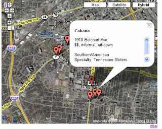
Last night we launched a cool new feature: sidebars. Now when you create a map with a bunch of different points, you can display titles for all your data in a table beneath the map (thumbnails are also displayed under wider maps). When you click on a title or thumbnail, the corresponding info window will open on the map.
To show you how this works, I put together this map of notable Central Square institutions with some pictures I took this morning. If you want to see how the thumbnails work, there's a wider version of the map here.
One last thing: You probably noticed that the map above includes an ad. All maps that use the sidebar feature will include an add. Basic maps that don't use the sidebar feature will still be ad-free.
Wednesday, February 21, 2007
Atlas in Drupal? You Bet.
A few people have written wondering how to get Atlas working in Drupal. Earlier this week InsideVandy, the web site of Vanderbilt University's student newspaper, showed how it's done, launching this map on their site.
If you have problems getting Drupal to work on your site, you may have to add Atlas to your embed filter. For more about the embed filter, see Drupal.org here and here. And, of course, you can always get in touch with me.
If you have problems getting Drupal to work on your site, you may have to add Atlas to your embed filter. For more about the embed filter, see Drupal.org here and here. And, of course, you can always get in touch with me.
Thursday, February 15, 2007
Snow (and Atlas) Cover Boston
I've been posting a lot about Atlas' new photos features. Yesterday Boston.com published a great example of these features in action.
As part of their Valentine's Day blizzard coverage, they created an Atlas map that allowed their users to contribute snowy photos of dogs, robins, backyards and Valentines. You can see the map here or see an image of it below.

We're very excited about this map and other like it. Sites like Panoramio and Yahoo's World Explorer show how naturally maps and photos go together. There's lots of work left to do, but hopefully Atlas' new photo features make it possible for publishers to create similar photo communities on their own sites.
Give it a try, and if you have questions, let us know.
As part of their Valentine's Day blizzard coverage, they created an Atlas map that allowed their users to contribute snowy photos of dogs, robins, backyards and Valentines. You can see the map here or see an image of it below.
We're very excited about this map and other like it. Sites like Panoramio and Yahoo's World Explorer show how naturally maps and photos go together. There's lots of work left to do, but hopefully Atlas' new photo features make it possible for publishers to create similar photo communities on their own sites.
Give it a try, and if you have questions, let us know.
Wednesday, February 14, 2007
Pictures of The Gates (With New Photo Features)
Last night I came across a set of pictures I took two years ago when The Gates were up in Central Park. I've published them on the map below to illustrate a few tweaks we made to Atlas' photo-upload feature yesterday. (If you don't see the map, click through here.)
Here's a list of the key tweaks:
> We've increased the size of the thumbnail displayed in the info window to 200 pixels on the longest side (we maintain the dimensions of photos uploaded, so one side will probably be smaller)
> We've added a [+] next to thumbnails in the info window to show people that they can click through to a larger version
> We're resizing the larger version of the photo so it fits on people's screen and loads quickly.
These changes were suggested by our friends at Boston.com. If you have suggestions, please let us know. We'd love to hear from you.
Monday, February 12, 2007
How Do I Moderate?
Lots of folks using Atlas' user-contribution function ask us about the moderation feature.
If you want to let your readers contribute to your map, but are concerned about things getting out of hand, select "Moderate User Contributions" in the "Edit Map Properties" popup. When this option is selected, contributions or edits from users will be held in a queue for you to review before showing up on the live site.
To review and publish contributions in the queue, go to the edit screen of your moderated map and select "Moderate" from the list of links in the upper right corner of the map. Here's what it looks like:

Thursday, February 8, 2007
Where to Tango in Italy
One of the well-documented pleasures of building a web service is its unexpected uses. You never know who's going to find your site, and you never know how they're going to use it.
One of our favorite recent surprises is the popularity of Atlas on the Italian tango site Tanghéri. The folks in charge of this site published a map of places to Tango. (I don't speak Italian, so I'm guessing they're places to Tango.) They opened the map up for users to contribute, and have been getting a consistent stream of contributions for the past few weeks. Here's what it looks like:

If you're thinking about experimenting with the user contributions feature, this is a great site to check out -- even if you can't speak Italian.
One of our favorite recent surprises is the popularity of Atlas on the Italian tango site Tanghéri. The folks in charge of this site published a map of places to Tango. (I don't speak Italian, so I'm guessing they're places to Tango.) They opened the map up for users to contribute, and have been getting a consistent stream of contributions for the past few weeks. Here's what it looks like:
If you're thinking about experimenting with the user contributions feature, this is a great site to check out -- even if you can't speak Italian.
Wednesday, February 7, 2007
Your Photos, Now on the Map
About a year ago I spent some time traveling around South America with my sister. One of the highlights of the trip was a day we spent climbing to the top of Volcan Villarrica in southern Chile -- and more specifically, the 20 minutes it took to slide down the side of the volcano on our butts.
Using the new photo upload feature we added to Atlas yesterday, I just created a map of the area around Villarrica and added a few of my photos. You can see them in the infowindows when you click on the pins. Make sure you click on the thumbnails to see the full-sized images.
Also, if you click through to the map, you'll see that I enabled the user contributions. The photo upload feature works for map users the same way it works for map owners, so if you have pictures of Villarrica you can add them here too.
Tuesday, February 6, 2007
Cambridge Burgers Via Google Local Search
This morning we added a very cool new feature to Atlas: Google Local Search.
Now, if you want to map your favorite place to get a burger, you switch to the "Business Name" tab and enter the name. Atlas will restrict its search to the area visible on the map, so if you're zoomed out, you may have to enter the city and state. If you're already zoomed in on a specific area, just the business name should be fine.
Here's what it looked like when I searched for "Cambridge Common, Cambridge, MA":

Here's a map of burger joints in Cambridge. Feel free to add your favorites.
Update: In the comments, David Silver asked whether we were going incorporate civic institutions as well as just businesses. The answer is that the "business" search returns quite a few civic institutions. I added the main Cambridge Public Library and the Mayor's Office to this map.
Sunday, February 4, 2007
2269 Dan Marino Boulevard, Miami Gardens, FL
The Patriots will be watching the Superbowl at home today. So, like Barack, I'm routing for the Bears when they take on the Colts at Dolphin Stadium in Miami this evening.
Thursday, February 1, 2007
Aqua Teen Hungerforce & Video in Atlas
It's been a surreal day and a half here in Boston. Yesterday the whole city shut down because of a bomb scare that turned out to be guerilla marketing for the Aqua Teen Hungerforce (ATHF) tv show -- the suspicious objects were neon ATHF lights.
Boston.com has more on the absurdity here (including this Atlas map of all the "bomb" locations).
The artists who created the ATHF lights recorded the process on video, so this is a good opportunity to point out that it's very easy to add video to Atlas maps. You just add the video's embed code to your infowindow, then change the infowindow dimensions to fit your video (this option is listed under "Edit Map Properties").
Here's an example with the video of the lights going up. I can't embed the map into this page because I had to make it wider than the Blogger template in order to fit the video.
Subscribe to:
Posts (Atom)

